Meteorite Impact Cratering
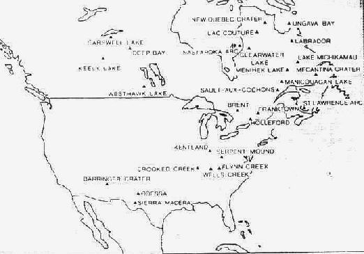
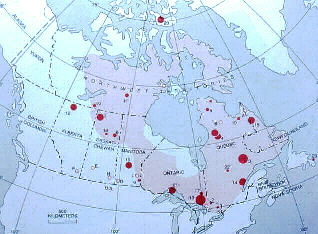
In the mid-1960's, I was involved in an expedition to the Mecatina Crater, which at the time was a suspected meteorite impact crater. This feature is a circular lake about 4000 feet in diameter and is located in Quebec, about 80 miles south of the border of Labrador and about 10 miles inland from the Gulf of Saint Lawrence. The map below shows the locations of known and suspected meteorite impact craters at that time. Notice the inclusion of the Mecatina Crater on this map.

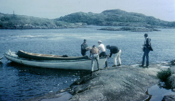
As a Penn State graduate student, I accompanied Penn State Professors Duff Gold and Barry Voight to the region, and I, in turn, was accompanied by Terry Harlacher, my friend who consented to be my field assistant for the summer. I purchased a canoe enroute and had some local fishermen transport us, my canoe, and our equipment along the coast to the mouth of the Mecatina River. This scene shows the canoe being unloaded from the fishing boat at the river mouth. I'm the person to the far right on the image.
The difficulties of trying to move 4 people and their equipment with only one canoe in such primitive terrain caused us to revise our plans. Drs.Gold and Voight used the canoe to go upstream to study the Mecatina crater and Harlacher and I stayed along the coast to study spectacular dike swarms that were abundant in the coastal area.
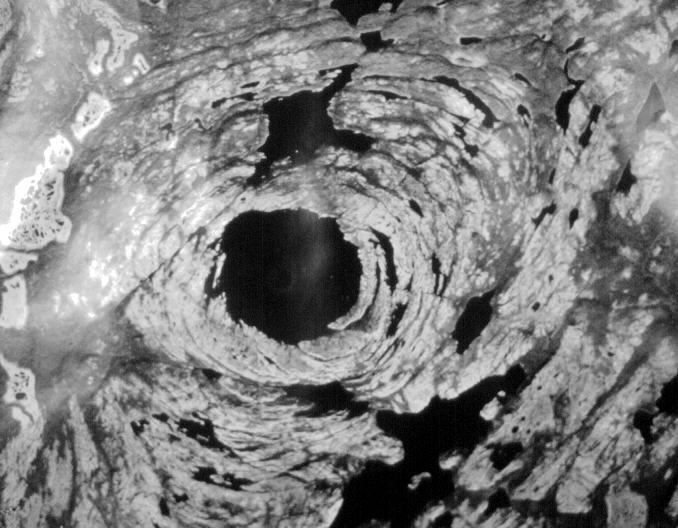
The 4000-foot diameter lake in the center of Mecatina crater has a compelling circular shape. The image below is a mosaic of approximately 22 individual aerial photographs and shows the lake and the region that surrounds it. North is to the top. The black on the image is water, the gray is forest, and the light tones are lichen, which is known in the area as "caribou moss."
Drs. Gold and Voight took the horizontal mosaic below from the southern shore of the lake. It shows a field of view that is about 180 degrees in width.

Although I did not reach the lake, I had the opportunity to rent an airplane equipped to make landings on the water. The airplane flew me over the lake so I could provide oblique aerial photographic views to the study. At the time, I was working near the mouth of the Mecatina River primarily out of the town of Mutton Bay, a portion of which is visible in the background of the photograph below.
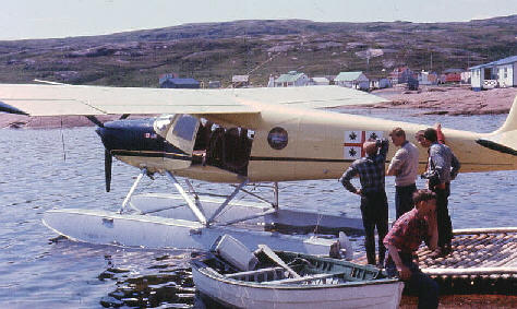
We obtained many photographs of the lake and surrounding area from the air. One is presented below.
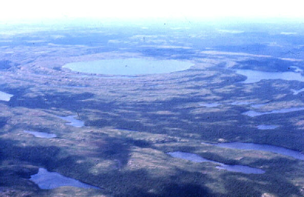
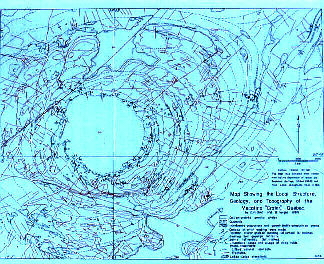
The geological study revealed the Mecatina structure is NOT a meteorite impact crater; rather, it is the result of multiple folding episodes of the bedrock, which is Grenville gneiss, with subsequent erosion and then recent glacial modification. The map below shows various bedrock geological features as blue lines and fractures and faults as red lines.
Maps produced in the 1990's which portray the distribution of Canadian meteorite impact craters show many more impact features now are recognized, but the Mecatina structure is conspicuously absent from these maps.
My study of the dikes along the coast of Quebec near the Mecatina structure resulted in my Masters degree, but since then I have maintained a continuing interest in meteorite impact cratering processes and I have since visited other confirmed meteorite impact craters: Meteor Crater in Arizona and the Reis Kessel in Germany. Meteorite impact cratering is an important process in geology and astronomy, both of which I teach. Since the Mecatina study was done in the mid-1960's, meteorite impact has been attributed to be a causative factor in the extinction of the dinosaurs and has been used to infer ages and age sequences of the surface features of several planets, many moons, and even the asteroids. It is a fruitful and compelling field of inquiry, and I am glad to have been some part of it. In 2004 I had the opportunity to visit the site of the Chicxulub Crater in the Yucatan of Mexico, although there is no surface expression to be seen.
The Mecatina study was funded by a grant from NASA (grant NSF-473).
See also my experiences at Meteor Crater, at the Reis Crater, and at the Chicxulub Crater.